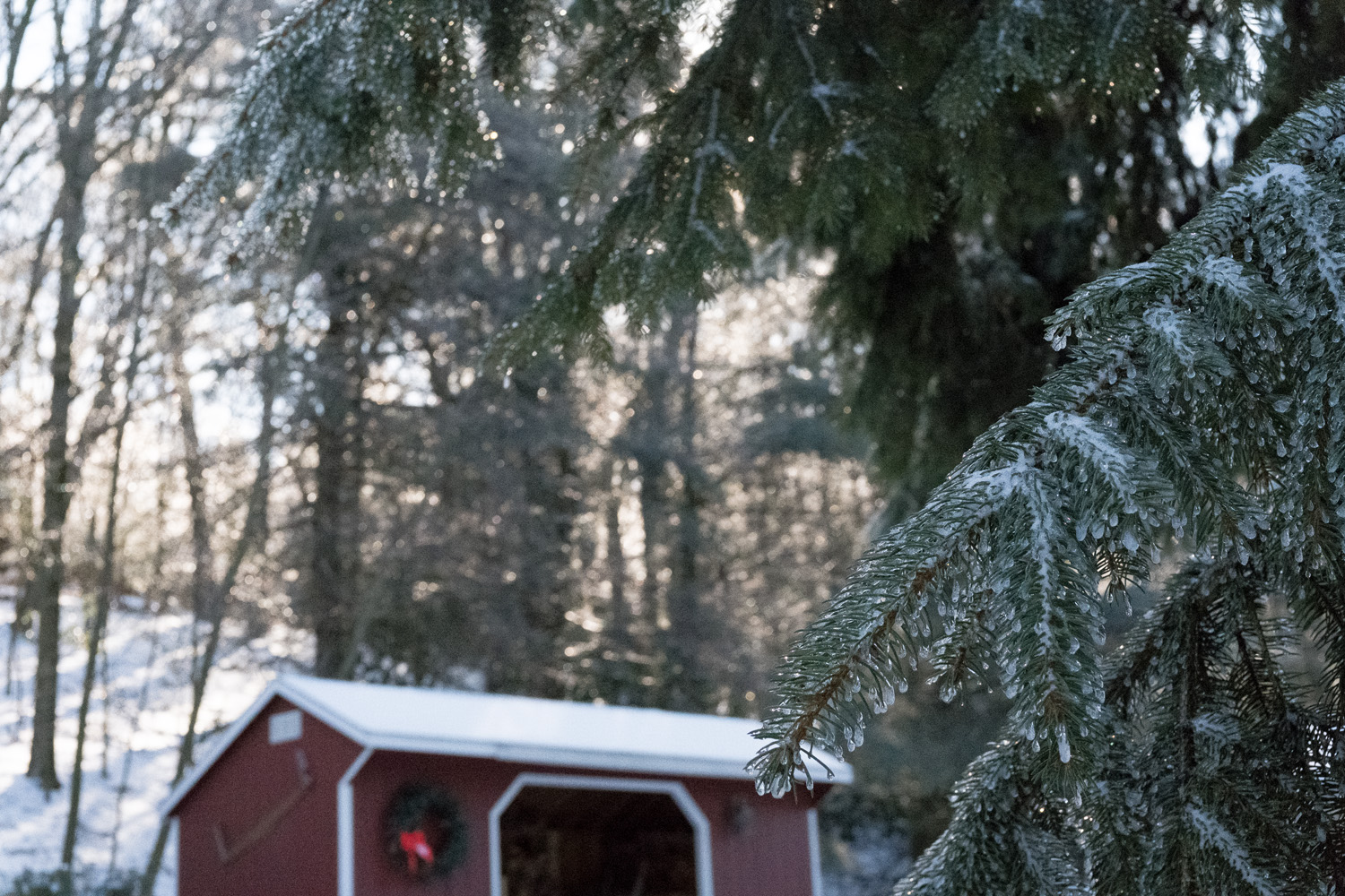
Droplets on Spruce ( Fujifilm X100f, TCL X100II)
I consider myself an interested, if not a keen observer of natural phenomena. For instance, I have over the last 25 years, kept a diary of snowfall events as measured on my back patio. I maintain 2 weather stations.
So when I ventured outside on the morning of January 13th, I noticed that something interesting must have happened overnight.
For 2 days before, we had rain, some heavy, with temps in the fifties and even sixties(F) which wiped out the little snow we had. Overnight Friday into Saturday, the cold front passed, which was predicted to provide a period of freezing rain, then sleet, then perhaps a coating of snow.
So I was not surprised that Saturday morning, to find the yard white again.
It was in the single digits when I went out to clear the walks, and defrost my truck. I was not surprised to see an icy veil over the tree branches and pine boughs. As I took in the lovely morning, I noticed that something looked different.
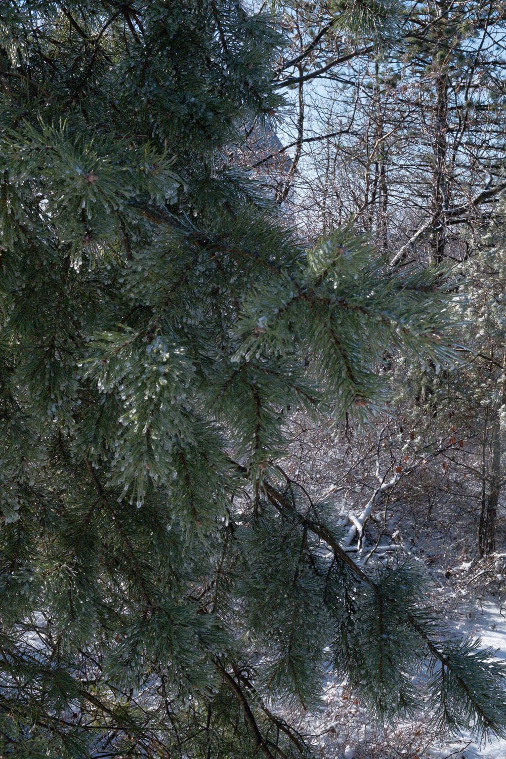
Droplets on Pine ( Fujifilm X100f, TCL X100II)
The bright morning sun filtered through the icy foliage looked extremely specular, an unfamiliar appearance to me
On closer inspection of the branches, I noticed not the uniform coating of ice that is the usual result of freezing rain. Rather instead, there were individual droplets of water, like crystal beads, on bare branches and evergreens alike.
This is why it looked unusual, for I was observing each tiny droplet as a tiny point of refracted light. The effect was quite stunning.
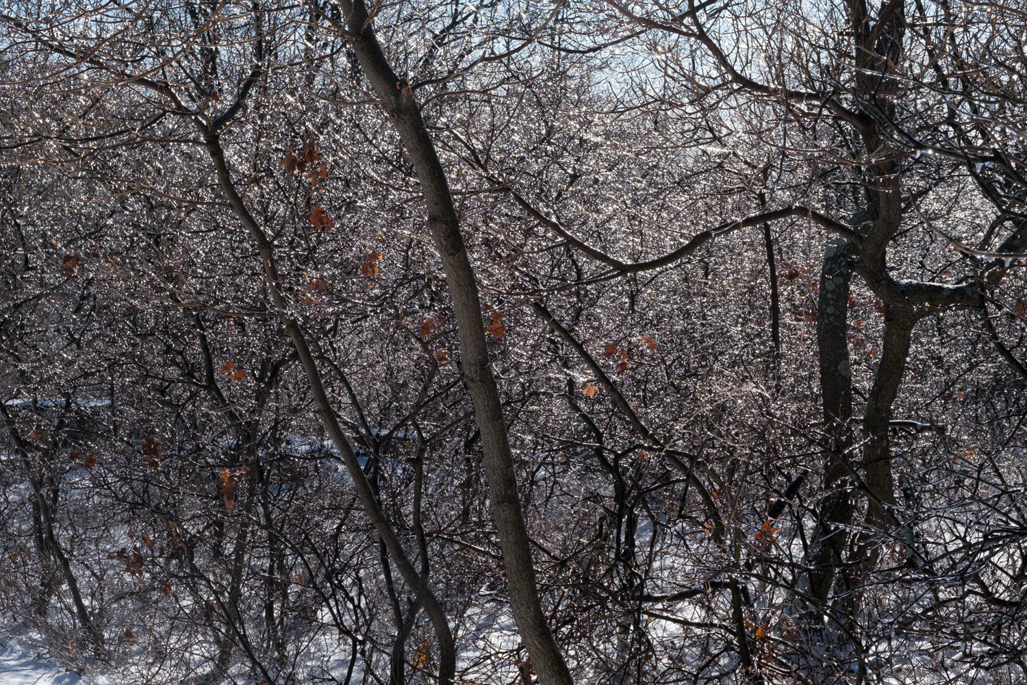
Droplets on Scrub Oak ( Fujifilm X100f, TCL X100II)
My community exists at between about 1650-2000 feet on the western edge of the Pocono plateau. the icing event occurred from about 1700 ft and above, with no icing below 1600 ft.
So what happened? I went to my online weather station which is located at around 1900 ft.
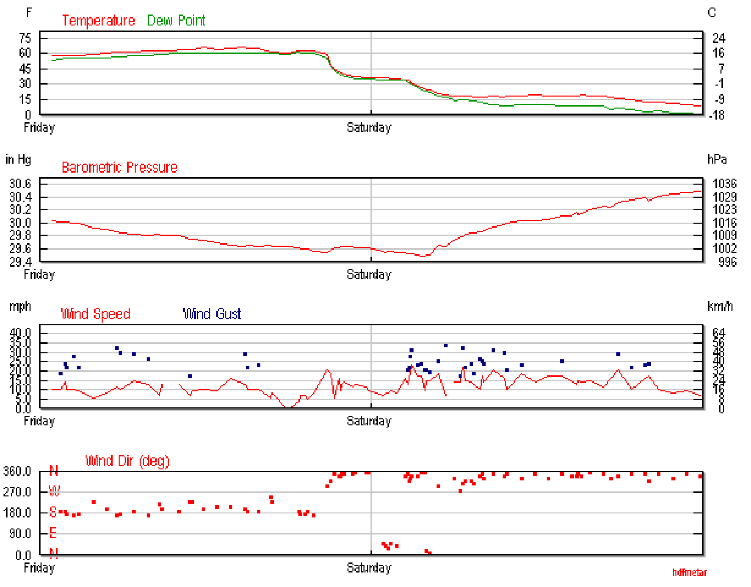
First, let me say that the sensor on this station is sheltered from the wind (as is most of my property) A 35 mph gust is impressive indeed and really emphasizes the strength of this front. Note that the temperature late Friday drops rapidly from almost 60 degrees (f) to just above freezing for a period of time and then plunges to the mid “teens” in just over an hour.
To form this ice pattern, I suspect it continued to rain with the temperature just above freezing, and then stopped during the final plunge. Sleet, and finally snow would have come in as, or just after the front had passed. And the droplets from the rain were in fact “flash frozen” by the unusually abrupt drop in temperature.
It’s admittedly a small thing, a slight deviation in our usual weather patterns. But as a photographer, it created a tangible difference in the appearance of a small portion of our natural world. One perhaps that can be anticipated in the future.
So why do I feel like such a geek?